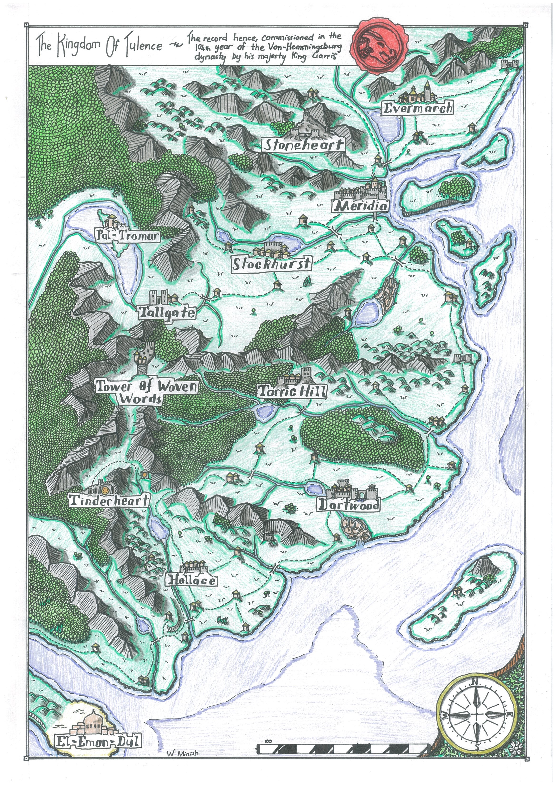
My first foray into the type of cartography I do now was when I ran a Dungeons and Dragons game for a group of my friends. As dungeon master I designed the kingdom of Tulence for the adventure to take place in, producing my initial two maps with some markers and cheap pencils that I had lying around.

Looking back at them today, I am still quite happy with these maps. The perspective views came out well and the simple colouring has a nice look to it. Looking at the Dusk Fortress map, my knowledge of medieval fortress design certainly wasn’t what it is today. Since drawing this map I’ve done more research on medieval fortress design to allow me to create more functional and historically accurate layouts. I may well write a further article or two in the future looking at these design considerations.
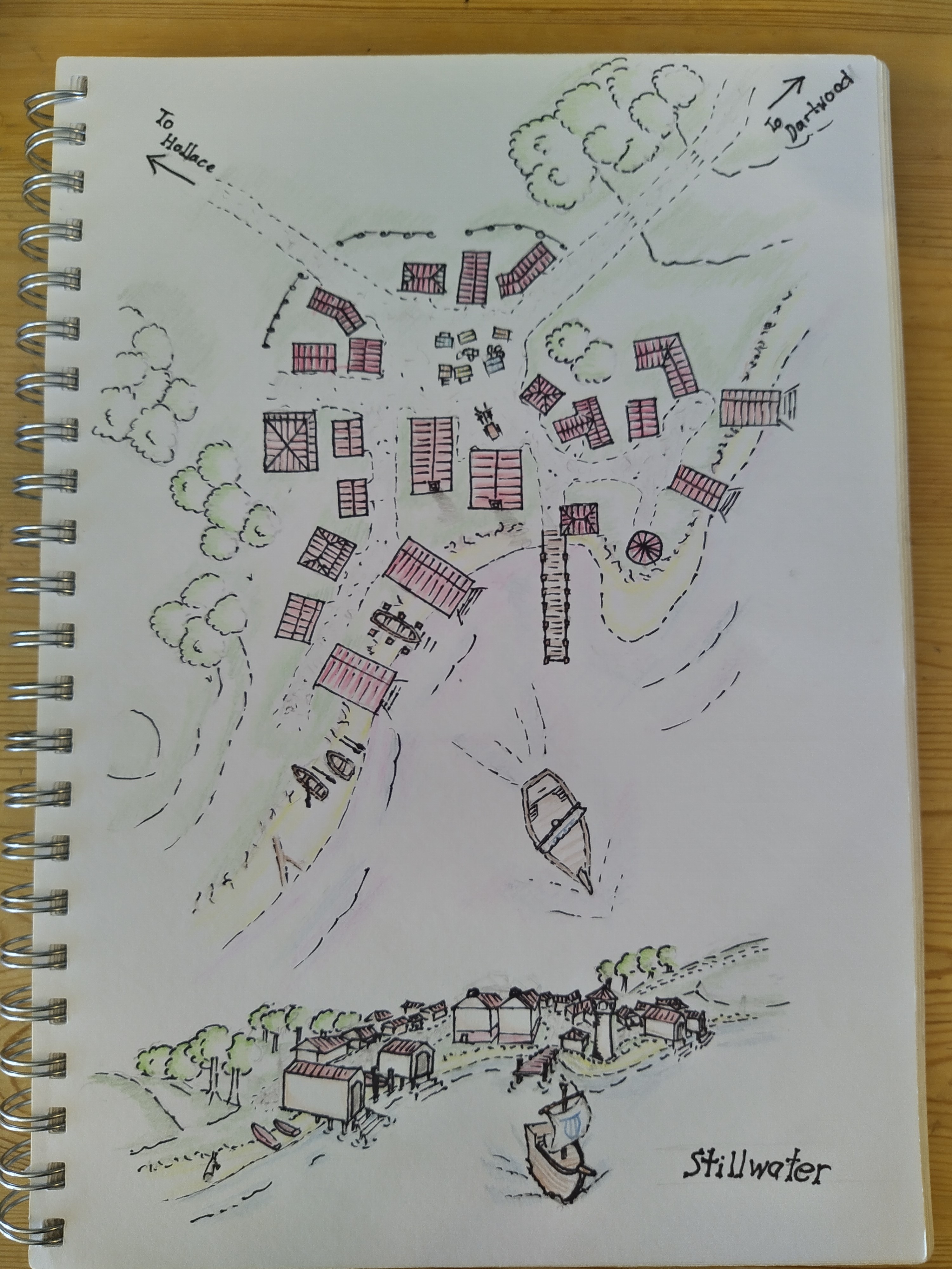
As the game progressed I produced a further two maps to round out the initial setting. One of the whole region, including the area for the next portion of the campaign, and one of the largest local town. The town map was never used much, as the players didn’t end up spending much time there, but it did give me a good chance to work on my technique and some practice drawing larger town maps.


As the campaign went on I again came to the point where I needed some new maps. I’ve always been a bit of a perfectionist and by now I had started looking around for some more inspiration to improve my maps. The D&D and Warhammer books I had at home proved to be quite a good resource. I also searched online and came across the Fantastic Maps blog where I found some new ideas and tutorials.
Fantastic Maps – Fantasy maps and mapmaking tutorials by Jonathan Roberts
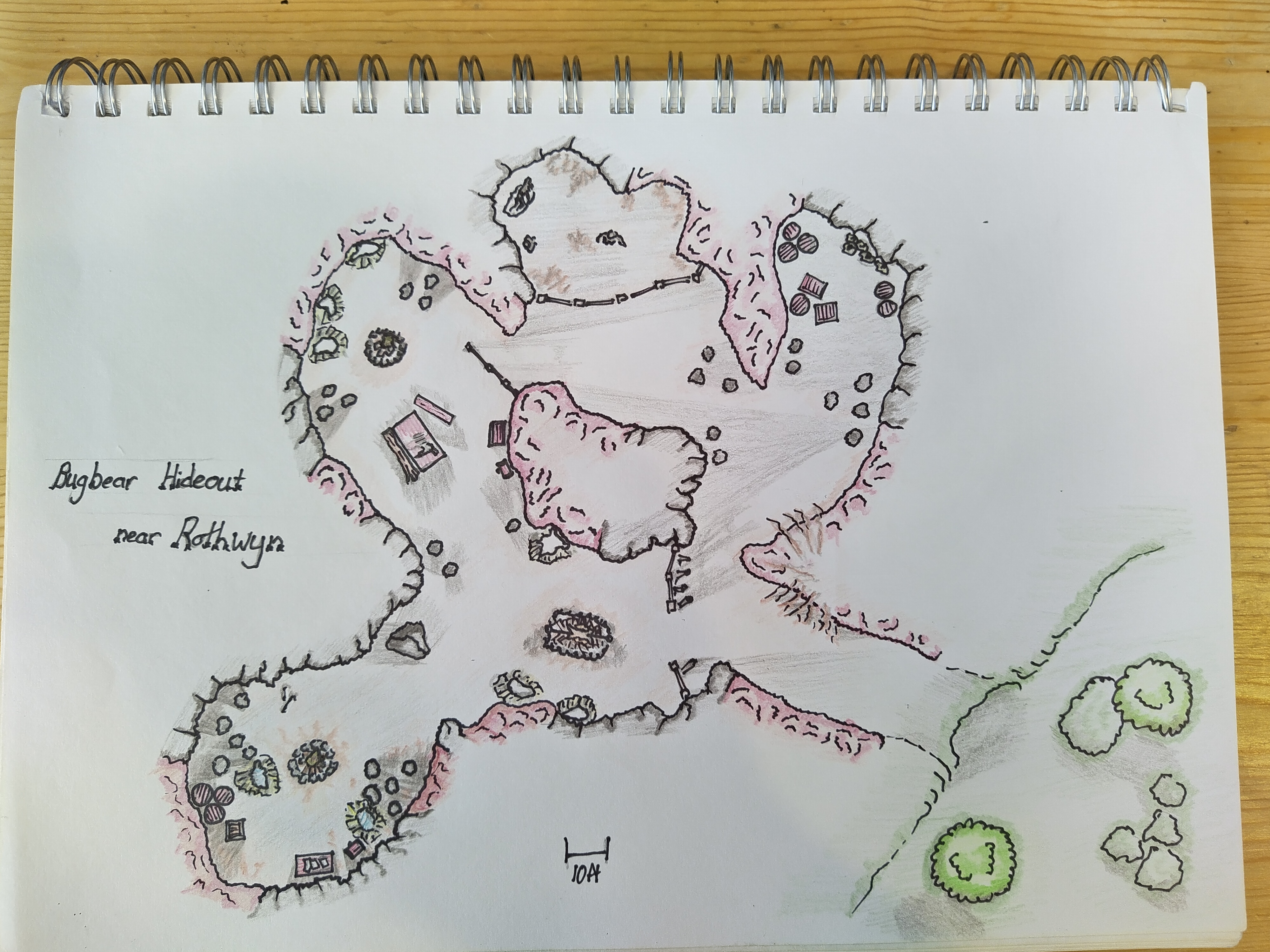
I began to experiment with shadow to try to give more depth to my maps. Over this period I produced a couple of new town maps as well as an encounter map for a single game session. In the Rothwyn map in particular, with the town built on a hill and a waterfall nearby, I wanted to try to capture that depth in the map. I remember being very pleased with it at the time, though looking back now it appears quite flat in comparison to some of my more recent work. The encounter map was also a challenge as the area is inside a cave with campfires casting light in multiple directions. The Dartwood map, due to the level of detail and the size of the town, was a large undertaking and I never got around to finishing the colouring on that one.


For the final round of my campaign, I purchased some better pens and coloured pencils, having decided that an upgrade to my materials was in order.


Around this time I also tried my hand at character art for some characters my wife and I played in a campaign taking place after mine had wrapped up.


After producing the final maps for my campaign in late 2018 I had quite a long break from map making because, at that time, I had no reason to continue.
Fast forward over two years to March 2020 and New Zealand going into lockdown. I found myself with quite a bit of spare time so I started drawing a few simple maps to keep myself occupied. My work from here will look familiar to some as it was around this time I created my website and joined the Cartographers’ Guild to start sharing my work more widely.


Around this time I also discovered the competitions on the Cartographers’ Guild. I found the community feedback really helpful and that, combined with the competitive aspect, helped me to quickly advance my skills. The two pieces below were produced for competitions at the end of 2020.

For Christmas 2020 my wife got me a set of ink dip pens and some black ink, which I have used for all of my work from this point. Since receiving that initial equipment I have increased my range of inks to include brown and, most recently, white. From the beginning of 2021 I entered many more challenges and completed several other maps besides.


During this time one of the challenges I competed in was the March / April lite challenge, in which I won my first award on the Cartographers’ Guild. My winning piece, “The Village of Spring”, is shown below.

In May of 2021 I made the most recent change to my mapping materials. After seeing many artists on the Cartographers’ Guild using watercolours and observing what could be achieved with those I decided that I had to give it a go. I quickly got into the swing of using watercolour paints and haven’t looked back since. Initially I produced a set of four small architecture drawings and then branched out into larger maps.


Not long after swapping to watercolours I achieved my second challenge win, this time in the May mapping challenge with the entry shown below; “Oxentarn, The Aviators Utopia”.

This brings us up to date with my completed work. I hope you’ve enjoyed seeing the development of my process and taking a walk with me through some of my past pieces.
